Met Office morning weather forecast
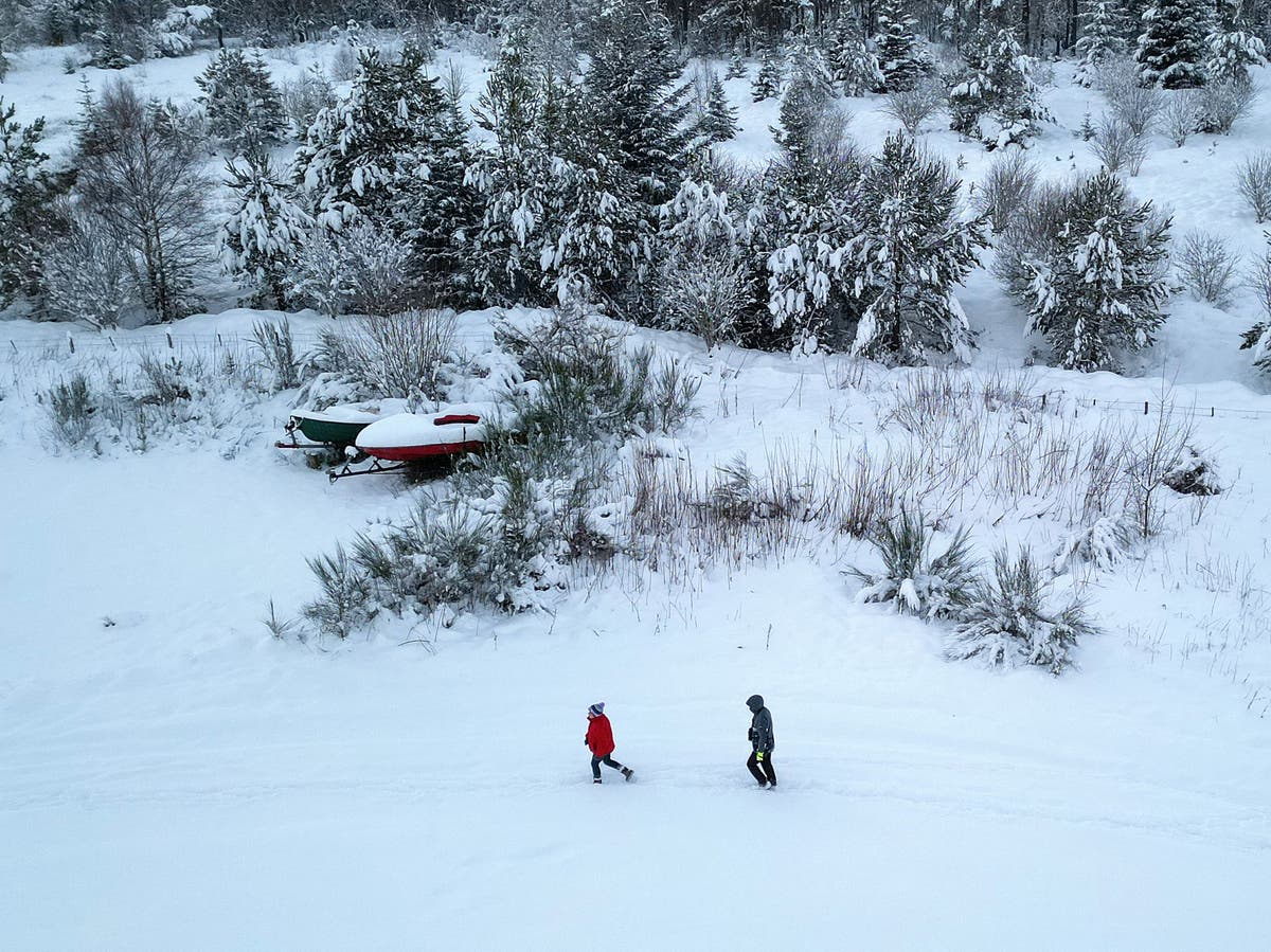
A blast of cold air from the north is expected to bring snow back to the UK next week as temperatures are expected to plummet to -10C in some areas.
Experts warned that snow will fall in Scotland and even potentially down south as cold air dubbed the “Troll from Trondheim” makes its way over the country from Norway
According to WXCharts, an interactive weather map provider using Met Office data, the UK will be coldest on 11 February, with certain areas of Scotland and Wales seeing minimum temperatures dropping to -10C, along with widespread snow cover with 2cm of snow falling per hour at its peak.
Jim Dale, Senior Meteorological Consultant at British Weather Services told The Independent: “We haven’t got to end of winter yet and next week will be colder. There will be snow in Scotland and the north and potentially in the south.”
In its long-range forecast, the Met Office has also said there will be some hill snow over the weekend and that “there is a chance colder conditions could start to feature” in the second week of February.
‘Month of contrasts’
January 2024 turned out to be near average in terms of temperature and rainfall for the UK, but it was a month of contrasts.
While there were long cold snaps, storms and heavy rain, the UK also recorded its highest January temperature.
The country had its sixth sunniest January on record, offering a welcome contrast to the previous month.
Storms, temperature extremes, and varied precipitation marked January’s weather, showing how abrupt the UK weather can be.
“Of course, contrasting winter weather in the UK isn’t a new phenomenon,” Met Office senior scientist Mike Kendon said. “What this January clearly demonstrates is just how abrupt these changes in weather type can be.”
Stuti Mishra2 February 2024 06:10
UK prepares for stormiest winter on record
Since storm naming was introduced in 2015 the furthest through the list the group has got is to number 11, Storm Katie, which impacted the UK in March 2016.
This year’s storm naming season is now just one name away from matching 2015/16’s number of named storms, with over seven months still to go until the list is reset again.
Stuti Mishra2 February 2024 05:10
Scotland could see 50-60 mph gales
As the weather takes on a milder tone across the country, relief from persistent rain is on the horizon for the Scottish Highlands.
However, higher grounds are bracing for strong gales ranging between 50-60 mph today, according to Met Office forecast.
“We could see gales for parts of Scotland, as well as some strong gusts of 50-60 mph across the Pennines,” the forecaster wrote on X, formerly known as Twitter.
Stuti Mishra2 February 2024 04:10
UK weather forecast for Friday
The day is set to start on a mild but cloudy note with temperatures climbing higher than the previous days, the Met Office forecast shows. Residents in the west and northwest can expect intermittent rain throughout the day, while brighter intervals are expected in the east and the sheltered areas on the lee side of hills.
Despite the cloudy conditions, temperatures are forecast to remain “very mild”, adding a touch of warmth.
But some gales are expected in parts of Scotland over the higher grounds, the forecaster says.
Friday morning temperature forecast
(Met Office)
Stuti Mishra2 February 2024 03:10
Since storm naming was introduced in 2015 the furthest through the list the group has got is to number 11, Storm Katie, which impacted the UK in March 2016.
Jim Dale, senior meteorological consultant at British Weather Services, warned the effects of these storms will only get worse alongside climate change.
Alex Ross2 February 2024 02:13
In pictures: Huge waves in the Shetland Islands
(AFP via Getty Images)
(AFP via Getty Images)
Athena Stavrou2 February 2024 00:30
Earthquake hits parts of UK as locals left fearing ‘car hit house’
An earthquake has struck parts of the UK, leaving locals fearing a car had crashed into their house.
The British Geological Survey (BGS) said the 3.3 magnitude quake hit the Isle of Mull in the Inner Hebrides at 7.30pm on Monday.
It said movement was felt on Mull itself, on surrounding islands and on the mainland, mainly from within around 50km of the epicentre, which was in the north west of the island.
Athena Stavrou1 February 2024 23:30
Snow expected next week
Following a relatively mild end to January, experts have warned that snow will return to the UK next week as temperatures plummet to -8C in some areas.
Jim Dale, Senior Meteorological Consultant at British Weather Services told The Independent: “We haven’t got to the end of winter yet and next week will be colder. There will be snow in Scotland and the north and potentially in the south.”
According to WXCharts, an interactive weather map provider using Met Office data, the UK will be coldest on 10 February, with certain areas of Scotland and Wales seeing minimum temperatures dropping to -8C.
The maps predict widespread snow cover with 2cm of snow falling per hour at its peak.
In its long-range forecast, the Met Office has also said there will be some hill snow over the weekend and that “there is a chance colder conditions could start to feature” in the second week of February.
(PA)
Athena Stavrou1 February 2024 22:30
Latest weather pictures – spring flowers
(PA)
(PA)
(PA)
Athena Stavrou1 February 2024 21:30

William Turner is a seasoned U.K. correspondent with a deep understanding of domestic affairs. With a passion for British politics and culture, he provides insightful analysis and comprehensive coverage of events within the United Kingdom.