An urgent “danger to life” alert has been issued for parts of Britain as more heavy rain and flooding is set to strike.
A rare amber weather warning remains in place until 12pm today across northern England and Wales.
Meteorologists have warned the “worst is yet to come” with up to a month’s worth of rain already falling in one day.
Over the next 24 hours, more heavy downpours are expected to cause chaos in Wales, northwest England and the east midlands.
Yellow weather warnings also remain in place for much of northern England and Scotland.
The Environment Agency has issued 121 flood alerts, 22 flood warnings and one severe flood warning covering the River Roe and River Ive from Highbridge to Stockdalewath.
It comes as one person died during a mudslide caused by heavy rain in Carlton-in-Cleveland.
The Met Office said the area had seen almost a month’s worth of rain over the past 24 hours – with 41.6mm of rain recorded in Loftus, a town 20 miles away.
LATEST DEVELOPMENTS:
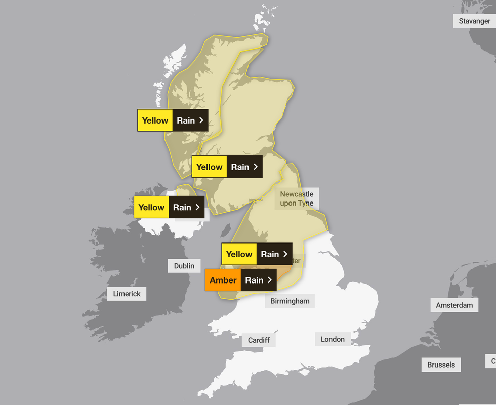
A rare amber weather warning remains in place until 12pm today across northern England and Wales
Met Office
Tom Morgan, a meteorologist at the Met Office, said that the “worst is yet to come”.
He said: “There was a lot of rainfall overnight in the northwest and southern Scotland, as well as in areas such as the Midlands, East Anglia and the Home Counties.
“The wettest area was Drayton Parslow in Buckinghamshire which saw 68.8mm in the last 24 hours. That’s almost a month’s rainfall in one day. For comparison, most other areas have seen an average of half a month’s rain in the same amount of time.
“But there is a lot of rain still to come in the next 12 to 24 hours, particularly in north Wales and north-west England. There could be some flooding in north Wales until midday on Thursday.”
Yellow weather warnings also remain in place for much of northern England and Scotland.
WXCHARTS
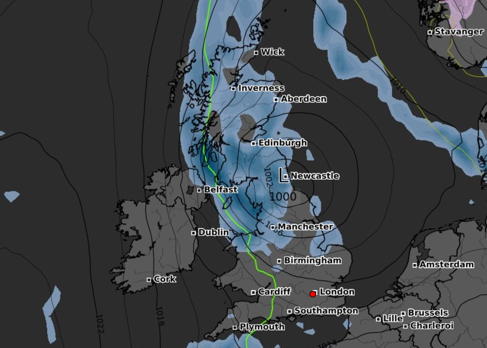
The low pressure – responsible for the wet weather – is expected to ease off over the weekend as conditions improve.
Morgan added: “The bank holiday weekend will likely see a mix of sunshine and showers, with temperatures expected to be back up to the low 20s.”
The Met Office said: “We’re still likely to see some showers on Friday, especially in the north, though there will some brighter spells in the south and east through the day.
“Later on Saturday, a front may move in from the Atlantic bringing a band of rain to Northern Ireland and western parts of Scotland. For many though, Saturday is likely to be a fair day, feeling warmer with temperatures slightly higher than average.”

William Turner is a seasoned U.K. correspondent with a deep understanding of domestic affairs. With a passion for British politics and culture, he provides insightful analysis and comprehensive coverage of events within the United Kingdom.