
A study has suggested that the tectonic plate located beneath India’s could be dividing into two.
India is the seventh largest country in the world, coming in behind the likes of Australia, Brazil and the US.
It’s said to be approximately 3.287 million km² and, if it was to be divided vertically – it would become two countries each around the size of Mongolia.
But India isn’t thought to be splitting vertically, and scientists believe it’s potentially sheering horizontally instead.
The theory was first presented at the American Geophysical Union conference which took place in December 2023.
The study – titled ‘Slab tearing and delamination of the Indian lithospheric mantle during flat-slab subduction, southeast Tibet’ – looks into the formation of the Himalaya.
The Himalaya is a mountain range spanning over five countries – India, Pakistan, Nepal, China and Bhutan – and according to the Geological Society, ‘the Himalayan mountain range and Tibetan plateau have formed as a result of the collision between the Indian Plate and Eurasian Plate which began 50 million years ago and continues today’.
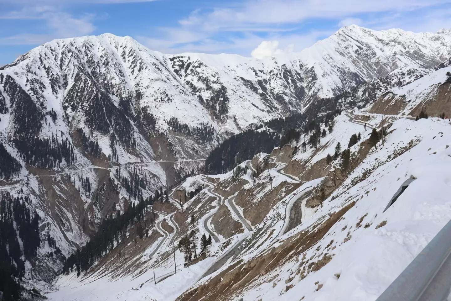
Researchers looked at the plates underneath the Himalaya. (Getty Images/ Nazim Ali Khan/ NurPhoto)
The study – led by Lin Liu, Danian Shi, Simon L Klemperer et al. – started by investigating the levels of helium present in the Tibetan springs and presented a new theory about the plates that lie underneath the mountain range.
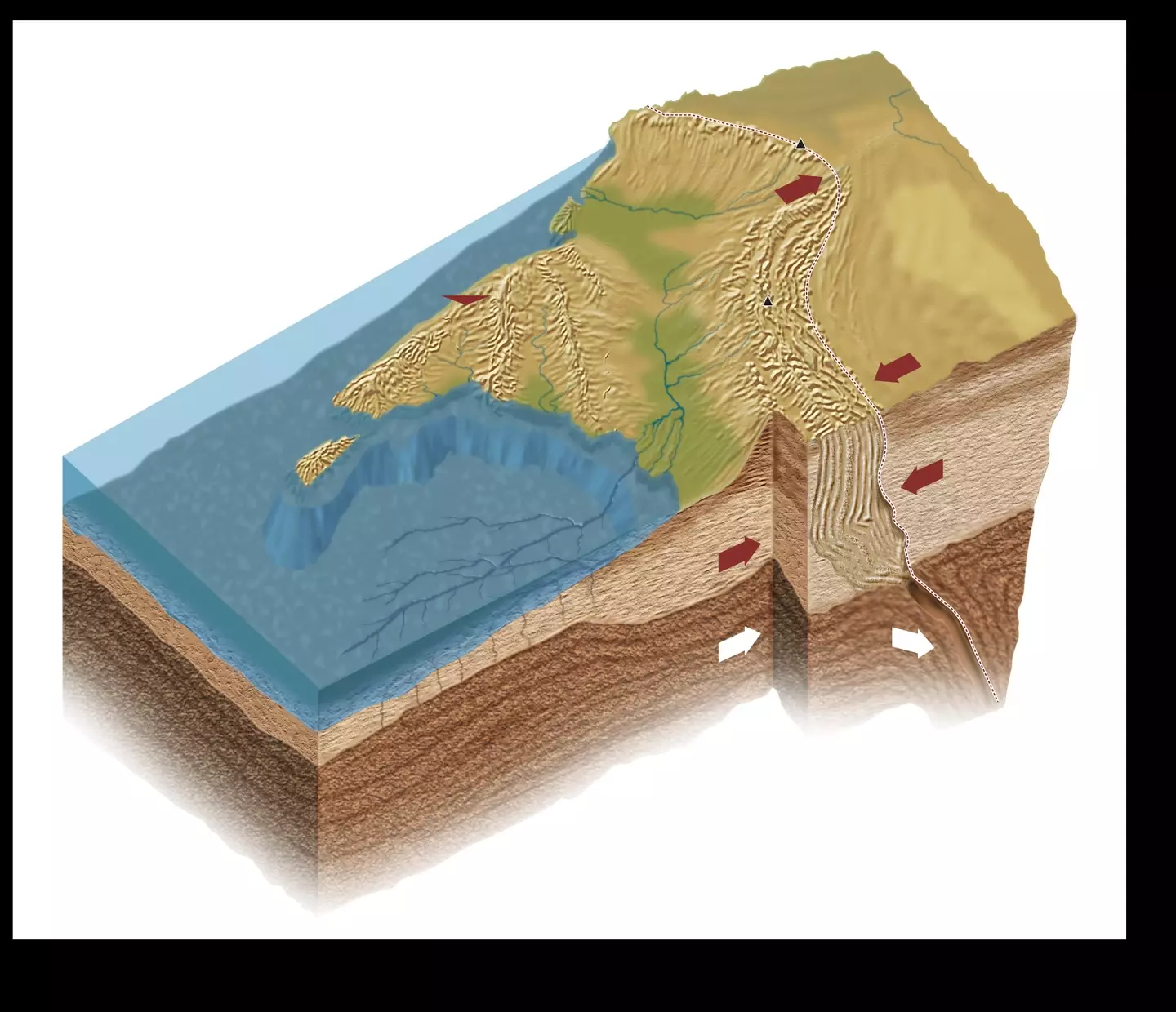
The study found the levels of helium were higher in southern Tibet compared to northern Tibet, suggesting the Indian tectonic plate is splitting in two underneath the Tibetan plateau.
The study then used ‘3D S-wave receiver-functions’ to analyze the Indian Plate.
The receiver function technique works by using information from teleseismic earthquakes to image the structure of the Earth and its internal boundaries.
The study details, as published in ESS Open Archive: “Our 3D S-wave receiver-functions newly reveal orogon-perpendicular tearing or warping of the Indian Plate.”
The study focused on the Indian and Eurasian tectonic plates. (Getty Images/ DEA / D’ARCO EDITORI/De Agostini)
One of the images appeared to show evidence of the top and lower slabs of the Indian Plate appearing to detach.
This subsequently suggests the Indian Plate is ‘underplating’ or ‘subducting’ beneath a ‘mantle wedge’.
The study resolves: “Our SRFs objectively map depths to distrinct Indian and Tibetan lithosphere-asthenosphere boundaries across a substantial region of south-eastern Tibet.
“The inferred boundary between the two lithospheres is corroborated by more subjective mapping of changing SWS parameters, and by independent interpretations of the mantle suture from mantle degassing patterns and the northern limit of sub-Moho earthquakes.”
Basically, this means the Indian Plate would peel into two, opposed to breaking into two.
Featured Image Credit: Planet Observer/Universal Images Group via Getty Images / DESHAKALYAN CHOWDHURY/AFP via Getty Images
Topics: India, News, Science

Dr. Thomas Hughes is a UK-based scientist and science communicator who makes complex topics accessible to readers. His articles explore breakthroughs in various scientific disciplines, from space exploration to cutting-edge research.


